The posts below are listed in the order they were made, which isn't necessarily the order in which the walks will be taking place. Use the links on the right to go to a specific post.

Walk on 21st January

Date: Sunday 21st January 2007

Time: 10.00am

Starting point: meet in the car park in Findon Valley at the junction of Shepherd's Mead and Coombe Rise, grid reference TQ087056. This is the most southerly of the two car parks and can be reached by turning off the A24 by the library.

A 9 mile circular walk passing over Cissbury Ring with views later of Deep Bottom, Canada Bottom, Stump Bottom and Buddington Bottom.

On the maps below, the start point is at the centre of each map.

Images produced from the Ordnance Survey Get-a-map service. Images reproduced with kind permission of Ordnance Survey and Ordnance Survey of Northern Ireland.

17th December Walk Photos

Another beautiful day with clear blue skies and very little wind. But when the sun starts to go down it gets chilly very quickly. A slightly shorter walk this time, just 8 miles.

Here's the view looking towards Longfurlong. The long dark shadows of winter are very noticeable.

This is Patching Pond where our walk finished.

Walk on 17th December

Date: Sunday 17th December 2006

Time: 10.00am

Starting point: meet in the lay-by by Patching pond (on the road to Patching from the junction of the A27/A280), grid reference TQ087056.

An 8½ mile circular walk passing through Clapham Wood and Michelgrove Park, but no pub stop.

On the maps below, the start point is at the centre of each map.

Images produced from the Ordnance Survey Get-a-map service. Images reproduced with kind permission of Ordnance Survey and Ordnance Survey of Northern Ireland.

3rd December Walk (No photos!)

Immediately preceded by gale force winds and torrential rain, we started out wondering what was in store for us. As it turned out we needn't have worried, after the first half hour it remained dry for the rest of the walk with plenty of sunshine – but we didn't lose the strong winds.

Let's hope next time the weather will look more promising before we start out.

Walk on 3rd December

Date: Sunday 3rd December 2006

Time: 10.00am

Starting point: Outside the Frankland Arms public house in Washington, grid ref TQ122129.

This is another walk I'm leading for the Sussex Pathfinders Rambling Club, but anyone can join us. It will be 12 miles, but after the first 7½ miles we'll be very close to the start point so anyone wanting to cut the walk short at that point will be able to do so.

19th November Walk Photos

Yet another bright sunny day, clouding over just towards the end of our 9 mile walk.

The view from Southwick Hill looking back over Shoreham, Lancing and Worthing.

Looking towards Devil's Dyke where we stopped for lunch, with Wolstonbury Hill on the left and Brighton on the right.

Walk on 19th November

Date: Sunday 19th November 2006

Time: 10.00am (NB this is earlier than previous walks)

Starting point: Meet at the northern end of Upper Kingston Lane in Shoreham, grid ref TQ238066 - park in surrounding roads. You can see street maps showing the start location from Multimap and Streetmap.

On the maps below, the start point is at the centre of each map.

Images produced from the Ordnance Survey Get-a-map service. Images reproduced with kind permission of Ordnance Survey and Ordnance Survey of Northern Ireland.

15th October Walk Photos

Another lovely day, just like summer, 10¼ miles through The Mens ancient woodland and along parts of the old Wey and Arun Canal.

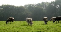
Those are some serious horns. We didn't have to walk through that field, but shortly after we crossed a field with a rather large bull.

Sometimes Ann will say "You must take a photograph of that, Keith," so I just do as I'm told. This was at Hawkhurst Court in the middle of The Mens.

That dog appeared when we stopped for lunch. I think he was after something.

1st October Walk Photos

Well, considering the forecast we were lucky with the weather, only one short shower. But didn't we have some wind!

Here we are taking a break.

I've cheated slightly with the rest of these photos - they were taken on the route we walked, but not on the day of the walk.

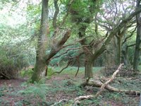
In the woods in Michelgrove Park.

This is one of my favourite views in this area. The farm (Lower Barpham) reminds me of the toy farm sets that kids used to play with.

Looking west from Barpham Hill.

Near Lee Farm.

Walk on 15th October

Date: Sunday 15th October 2006

Time: 10.30am

Starting point: Meet on the south side of Wisborough Green, grid ref TQ049259 - park around green.

We'll be walking through The Mens ancient woodland and along parts of the old Wey and Arun Canal.

On the maps below, the start point is at the centre of each map.

Images produced from the Ordnance Survey Get-a-map service. Images reproduced with kind permission of Ordnance Survey and Ordnance Survey of Northern Ireland.

17th September Walk Photos

Exactly 9 miles this time on a beautiful day's walk that took us from Lavington Common up onto the Downs, and back via Graffham Common.

This is the view from the spot where we stopped for lunch.

John attempting to make an exit from the field with the frisky donkey.

Walk on 1st October

Date: Sunday 1st October 2006

Time: 10.00am

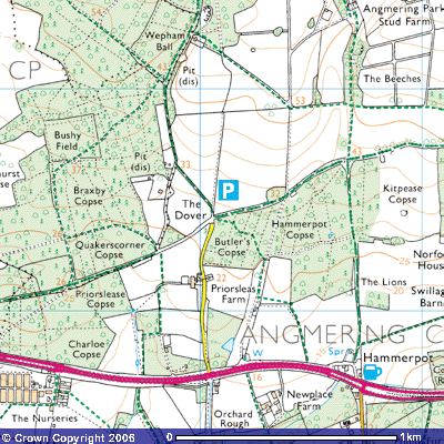
Starting point: Car park at The Dover, grid ref TQ061064. Travelling east on the A27 from Arundel towards Worthing, just before you reach Hammerpot look for a large sign for Dover Lane on the left. Take this turn and follow the road past the farm to the end of the lane (just under half a mile). There's a car park in the woods on the right. From Worthing there's no right turn into Dover Lane, so travel west along the A27 past Hammerpot and look for a U-turn sign back to Worthing and Brighton, take this and then take the turn for Dover Lane as before.

This is a 12 mile walk I’m leading for the Sussex Pathfinders Rambling Club, but anyone can join us. N.B. There’s no pub stop on this walk.

On the maps below, the start point is at the centre of each map.

Images produced from the Ordnance Survey Get-a-map service. Images reproduced with kind permission of Ordnance Survey and Ordnance Survey of Northern Ireland.

Last Sunday's Walk (27th August)

Thanks to everyone who came along, I checked the distance and it turned out to be only 9.3 miles. Here are some photos.

Our first stop was here, where those of us who are more easily led astray succumbed to the temptations of the nearby ice-cream van.

Views from Wolstonbury Hill looking east towards Jack and Jill.

Happy wanderers on the way to the pub. Notice how they're all ahead of me.

Railway tunnel entrance at Clayton.

Happy wanderers on their way back from the pub (visible in the distance). Notice how they're now all behind me.

Walk on 17th September

Time: 10.30am

Date: Sunday 17th September 2006

Starting point: Car park at Lavington Common, grid ref SU949187. From the A285 about a mile north of Duncton (or two miles south of Petworth), turn west onto a minor road and travel just over a mile (before you reach any other road junctions) to a car park on the right.

We’ll have the option of stopping at a pub on this walk.

There are maps below at various scales, the car park is at the centre of each map.

Images produced from the Ordnance Survey Get-a-map service. Images reproduced with kind permission of Ordnance Survey and Ordnance Survey of Northern Ireland.

FAQ

How far do you walk?

Usually 8 to 10 miles, sometimes a bit more. Don't worry if you've never walked this distance before, if you're capable of spending a few hours wandering around the shops you should manage one of our walks without any problems.

Is there any charge for these walks?

No.

What happens if the weather is bad?

If it's very bad the walk may be cancelled, although at the time of writing (after 18 months of walks) this has never happened yet. You can check this web site just before setting out to see if the walk is cancelled. When you come on a walk we can exchange phone numbers if you wish, then in future you'll be able to call me to see if the walk is still on or I can call you if the walk is cancelled. You'll also be able to call me if you're going to be late turning up so we know to wait for you.

What do I need to bring?

A drink, some lunch, waterproofs, boots/shoes/trainers/sandals according to preference - bearing in mind it could be muddy after recent rain and we may be walking through grass with thistles and stinging nettles. (Sounds bad doesn't it? It's not really that bad.)

Can I bring a dog?

Yes (but see below), if it's well behaved. Be sure to bring a lead for walking along roads and through fields of sheep and cattle. You should be aware that a farmer is legally entitled to shoot a dog which is worrying his animals. (Please note that when the walk is for Sussex Pathfinders, dogs are not allowed.)

Do the walks include a pub stop?

Sometimes, but not necessarily at lunch time. Often a decision on whether to visit a pub is made while we're on the walk.

How did this all start up?

See In the beginning.

How can I be informed of updates on this site without checking it daily?

You need to subscribe to a feed. There are links for Atom and RSS feeds on the right of the page.

I've got another question. How can I contact you?

You can e-mail me at post2keith@googlemail.com.

Alternatively click on the 'Comments' below and leave a comment with your question. I'll add your question to this page. If you want me to contact you directly with an answer, you'll need to provide contact details in your comment. These contact details will not be seen by other visitors to this site. (You can leave a comment to any post on this site, these comments are not seen by other visitors until I've checked them.)

In the beginning

So what's this web site about? Well, for the last 18 months I've been leading a group of friends on monthly walks in the Sussex countryside. This site will enable anyone who doesn't see me regularly to find out where and when we're walking next. It's also a way for everyone to see some of the photos I take on the walks. Anybody else who happens to find this site can come along and join us if they want to - there's no need to make any arrangements with us, just turn up.

Over the next few weeks there will be more general information posted here for the benefit of those who aren't familiar with my walks, but beyond that most probably only a few updates each month.